 |
 |
 |
|||||||||||||||
 |
|||||||||||||||||
|
|||||||||||||||||
Chapter 6
The Chiloe Island 60cm gauge railway
Main pages
The Chillan to Las Termas line •
Appendices
3 Analysis of Chilean 60cm gauge locos •
5 Documents from prior to construction •
6 Documents during construction •
7 Documents from later years •
Saboya to Capitán Pastene line additional material
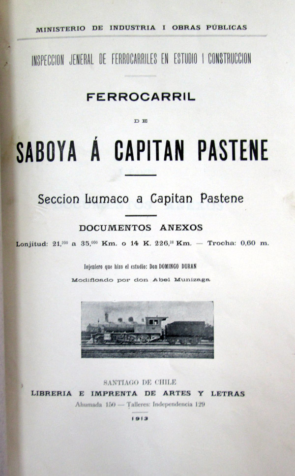
The cover of the pre-tender booklet containing survey information about the Lumaco to Capitán Pastene section of the line. Such booklets were produced for most railway construction projects.
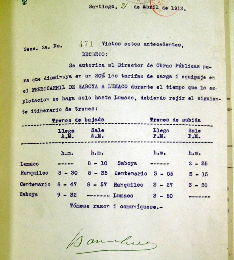
A provisional timetable for the first months of operation whilst the contractor was still on site.
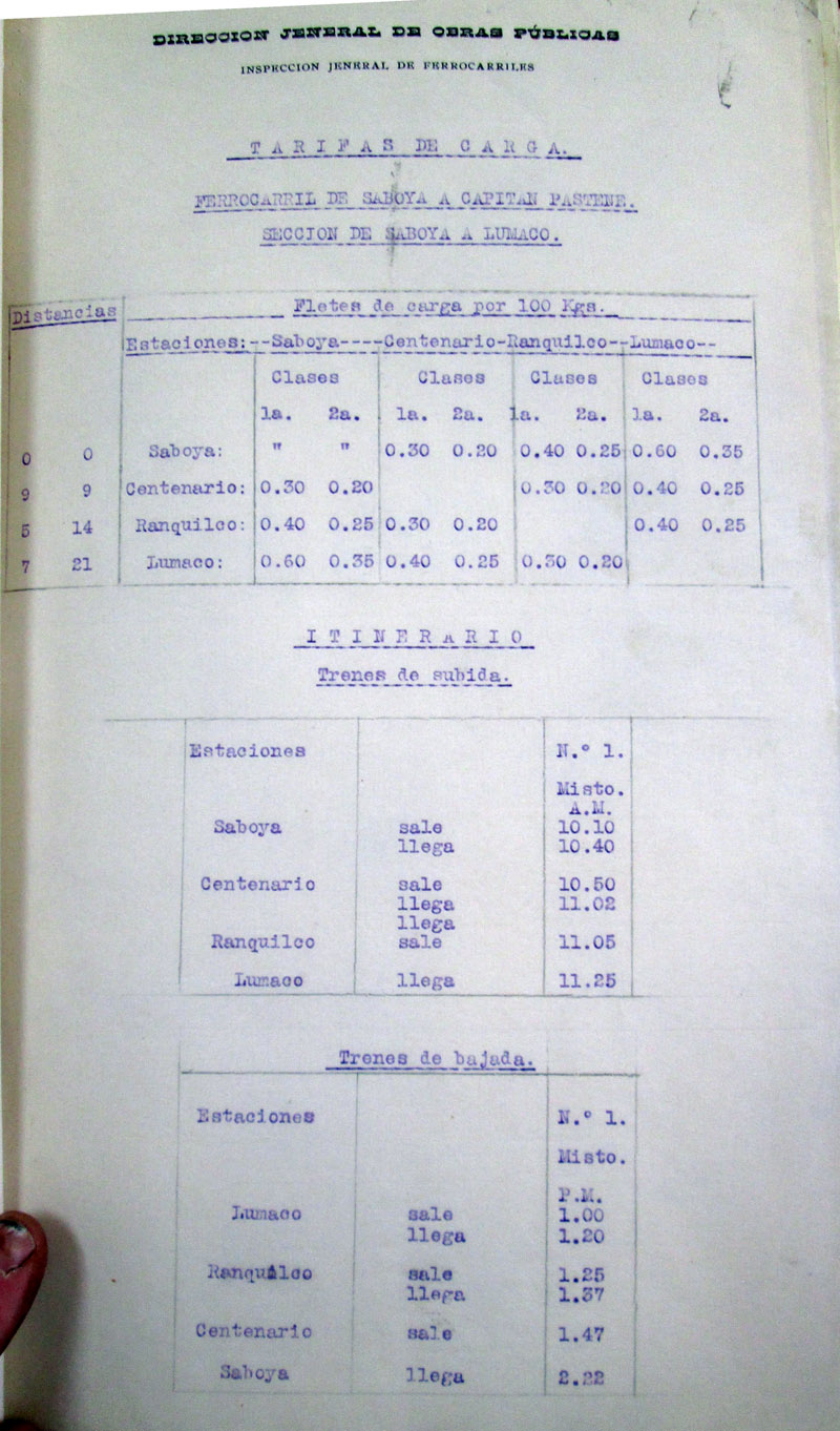
Another timetable sheet from the very first stage of operation.
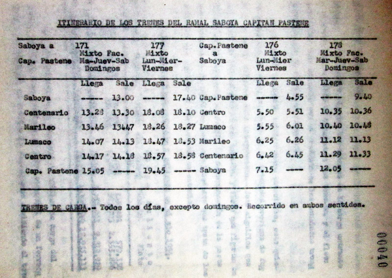
The timetable in operation during 1954 when Señor Luis Katonar Z. was studying the railway's operation for his University of Chile thesis.
Surviving relics
A visit was paid to various locations on the line in early 2016, including walking from Capitán Pastene down to Lumaco. The following photographs were taken during that visit.
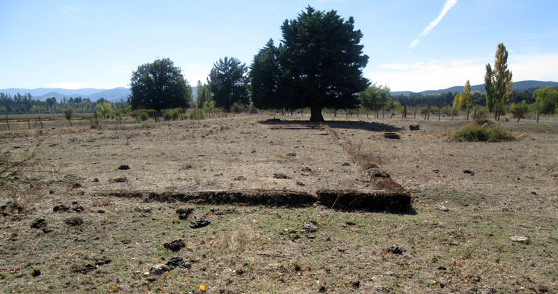
At Saboya only concrete foundations can be seen, including those of the loco shed pits and the turntable. The site is largely covered in grass, though the adjacent broad gauge route is partially hidden by bramble bushes.
The first view looks south along the broad gauge alignment. The narrow gauge tracks would have been parallel and immediately to the right, and would have curved away out of the picture in front of the trees in the background.
Looking south from just south of where the Saboya station building would have been. The narrow gauge route curved away to the right on the low embankment, whilst the triangle and loco shed would have been just off to the left hand side.
Saboya loco shed pits, looking west. The turntable pit in the image that follows this one is just beyond the pits.
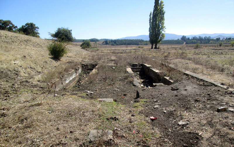
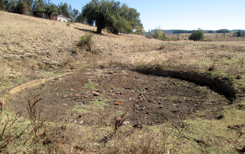
The site of the Saboya turntable, looking west. The narrow gauge route departed along the fenceline in the near background, and disappeared behind the higher ground on the left. One of the tipo b 0-6-0Ts fell into this pit during the early years of the line.
Looking back northward across the station platform edging. The tracks, both narrow and broad, would mostly have been to the right, though a single narrow gauge siding was shown running behind the station building in the plan above.
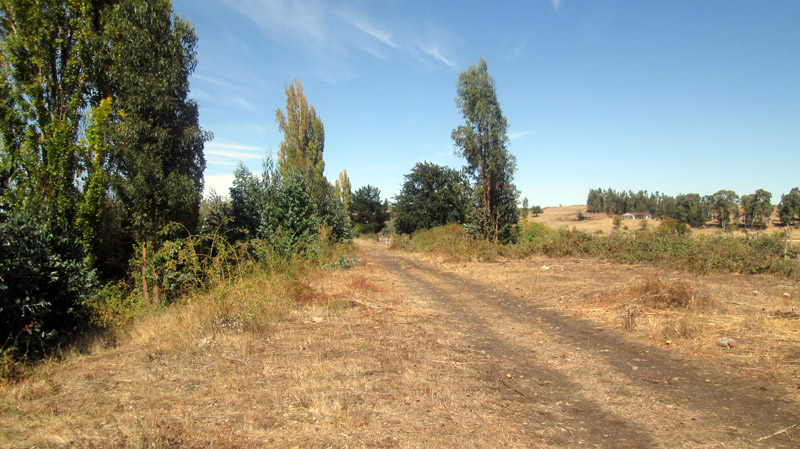
The line heads west over the ridge, apparently through open grazing land, and then takes a course southward for two or three kilometres before dropping to the level of the Los Sauces to Lumaco road. This section is clearly visible from the road, largely on low embankments, but has not been examined closely. Latterly it is within forest, and may well have been used recently for timber extraction vehicles as has happened later in its course. Once it reaches the road the route is clearly visible, on its west side, often close to the road where it has in parts been excavated to create a drainage ditch, but elsewhere sweeping further away into the fields, including a 400m section where the embankment has been bull-dozed away to permit centre-point irrigation to track across its course.
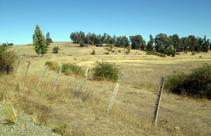
The station building at Centenario survives, seemingly as a dwelling. No obvious railway buildings are visible at Ranquilco, though farm building lie next to the track and may have had railway connections originally.
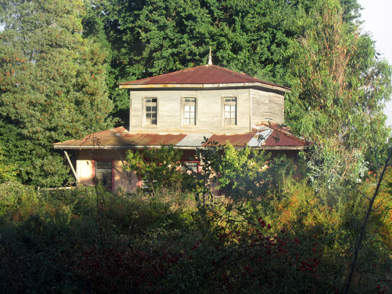
Approaching Lumaco, the two storey station building has clearly been used as a dwelling, though currently (2016) is vacant and boarded up. A concrete loading platform faces the building, but there are no other signs of infra-structure. The trackbed continues for several hundred metres until it reaches the erstwhile river bridge site, where concrete pier bases survive though the preceding section of embankment has been removed by floodwater.
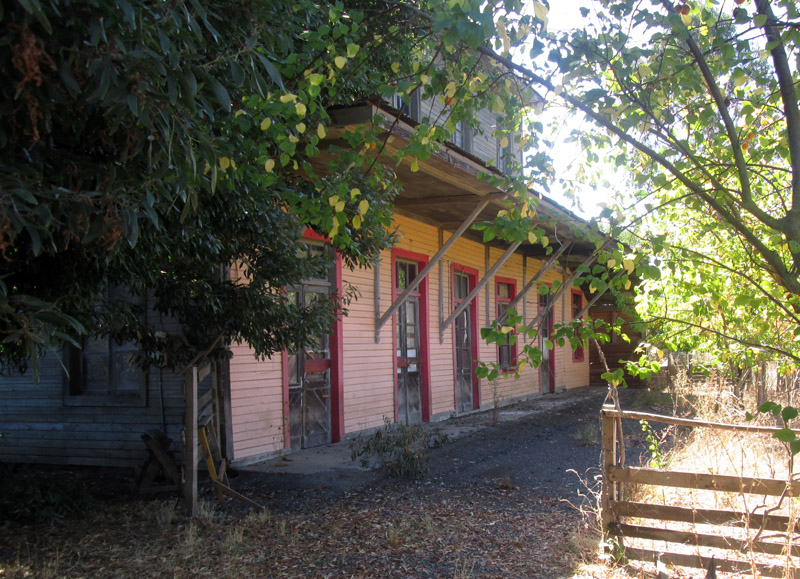
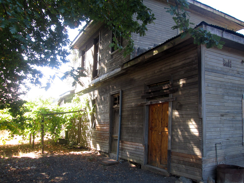
Lumaco station building, currently (2016) empty but still in reasonably good condition.
The front face of the building, that would have looked on to the tracks.
…and the rear of the building.
The road approaching the river crossing is rather higher at this point, and looking down on the site one can clearly see the line of trees beyond the bridge indicating the railway alignment curving right into Lumaco township. This is then followed by a left-hand curve, largely built-over in recent years, before the route departs from the town along the western edge of the floodplain.
The next couple of kilometres follows a low embankment with increasing numbers of trees through grazing land in a park-like environment. It appears to be a popular footpath, though the northern end enters a smallholding and this was not investigated so as not to intrude on the inhabitants' privacy.
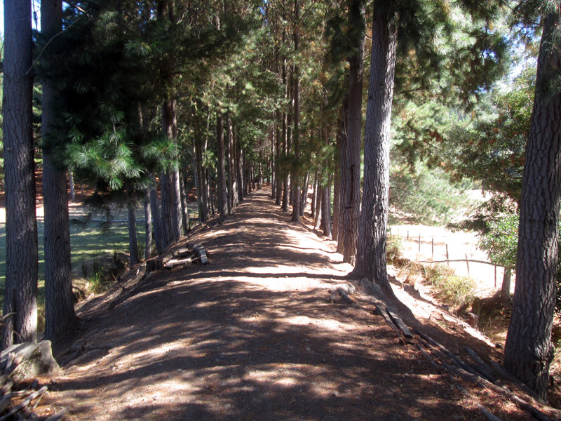
At the southern end of this section the trackbed can be easily accessed via a side road from the main Lumaco to Capitan Pastene highway, which will never be far away from now on.
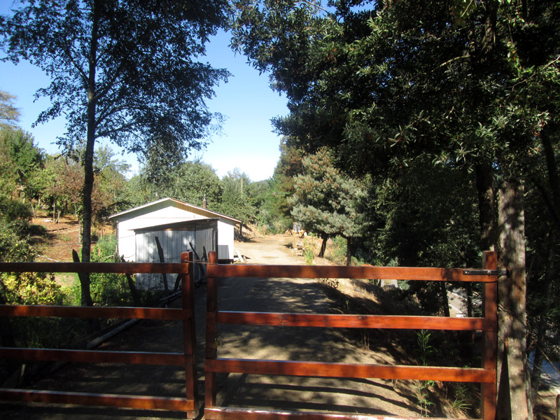
The next few kilometres can be walked by intrepid adventurers, for though the majority of the route is clear, some sections have been densely overgrown and occasional diversions back to the road or onto the fields above may be necessary. Parts on the other hand have been used as forestry access tracks. At one point the route rejoins the road where a couple of houses stand on the hillside above. There may have been a halt at this point.
The embankments and eventually the hillside shelf carrying the track get gradually higher from this point onward, until further progress is prevented by road widening having removed the hillside to such an extent that the trackbed has disappeared.
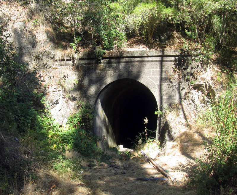
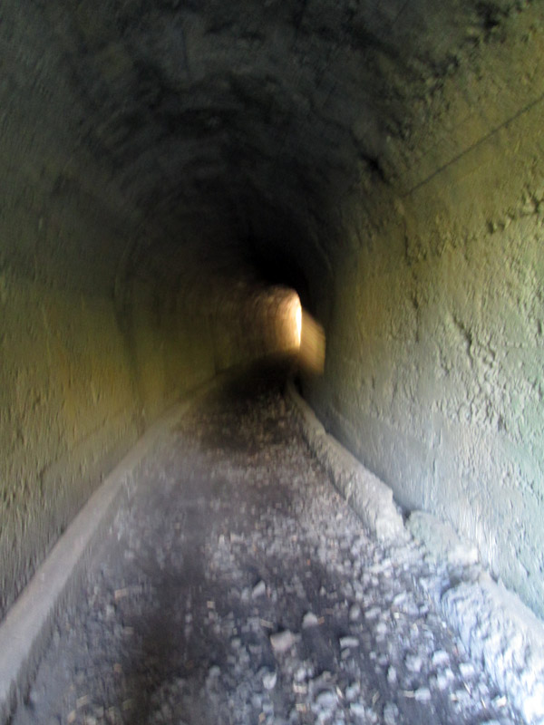
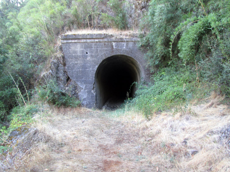
One interesting section can, however, be accessed. This is that between the two Pililcura bridges, where the road crosses to the west of the river and then back again. At the northern bridge an adventurous scramble up through cane thickets gives access to the track, whilst between the bridges a forestry access route takes off up from a roadside layby, and at the southern bridge there is an easy footpath uphill. This section includes the branch's only tunnel, which is dry and can be easily traversed without a torch, for though on a curve it is only 53m in length. The portals carry the date 1917.
The north portal
Inside the tunnel, looking toward the northern end.
The southern end.
The next three kilometres or so are impossible to follow continuously, for the trackbed is now 10m or so above the road and much has been removed. Odd sections could be reached, but only from one end, whilst anyone parking a car on the main road needs to be very wary of the frequent passage of heavy timber lorries.
Finally, a summit in the road indicates the point at which the railway took off left into its final large loop round a re-entrant side valley. The route is very obvious at this point, but as the other end is less clear this section was not explored by the writer, who was walking from the Capitán Pastene end.
The station appears to have been adjacent to the main road where it turns sharp left and then right at the foot of the town, but there are no surviving traces of buildings or facilities.