 |
 |
 |
|||||||||||||||||
 |
|||||||||||||||||||
|
|||||||||||||||||||
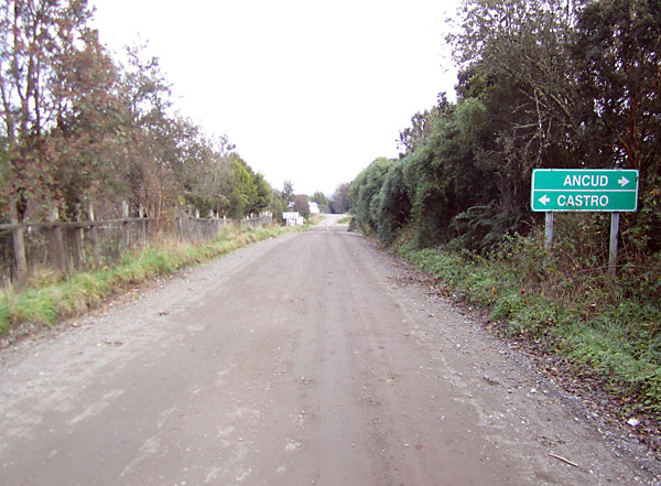
Along the route
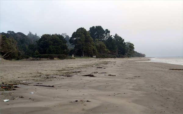
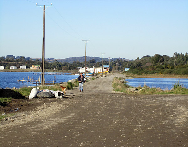
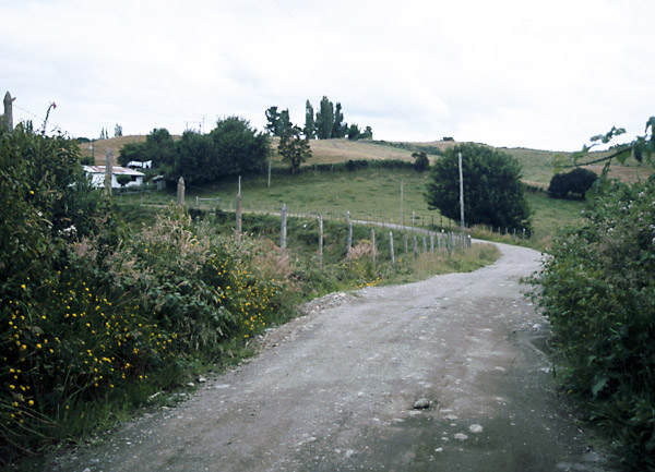
Lechagua Lechagua is not a well-defined settlement, more an area of scattered development amongst yards and small-holdings. As elsewhere along this shore, the sea invaded the land to varying extents at the time of the great 'terremoto'. It is difficult to tell where the original shoreline would have been in this view of Lechagua, but what is clear is that there is no sign of the original muelle, which would have been mid-way along the shore in this 2011 photo, but possible further right along a lower level shoreline.
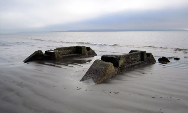
Walking back eastward along the beach toward Ancud, one encounters a number of concrete abutments, usually in close proximity to streams running out onto the beach. Given that the railway's original wooden bridges were replaced by concrete during the 1920s, maybe the same policy was applied to smaller structures such as these.
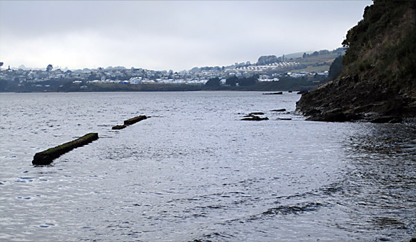
A couple of rocky headlands mid-way along the branch have the remains of low concrete retaining walls in front of them. This would seem to imply that the original shoreline was adjacent to the trackbed at these points.
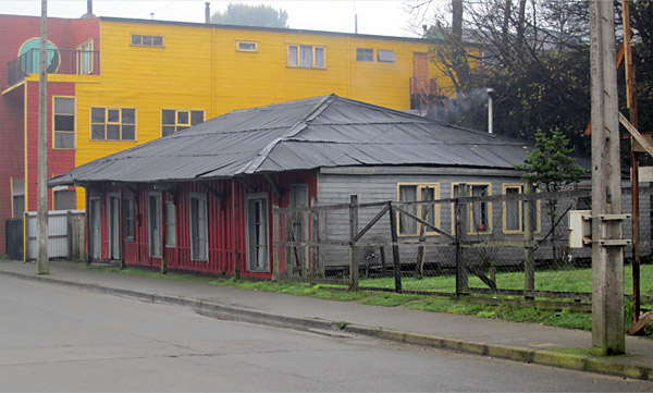
Closer to Ancud it seems that the railway took a more inland course, and one which climbed well above sea level. Few details are known of this, except that the initial start from Ancud station was up a street then known as Callé José Andrade. Ancud Ancud station building, on the north side of Calle Arturo Prat. Judging by the encroachment of nearby modern buildings, the long-term future of the station building cannot be assured. The wide eaves at the front of the roof have been propped with wooden posts since the closure of the railway.
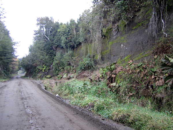
Along the estuary At a point where the main road curves south and starts to think about climbing steeply out of the built-up area, the railway crossed it again, heading out east across the marshes to the edge of the Rio Pudeto. This crossing was just before the big green road sign giving distances of Castro 79 and Quellon 165. From there the line remains on the flat for a couple of miles, along the right bank (true left) of the river. In order to maintain a reasonably straight alignment along the edge of the Rio Pudeto, the railway engineers built a couple of embankments across small bays. Whilst these have been built up higher since the earthquake they may still be followed on foot or by car.
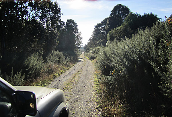
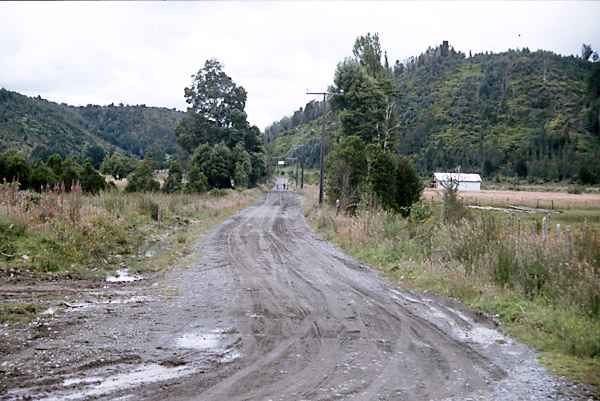
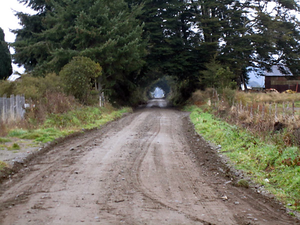
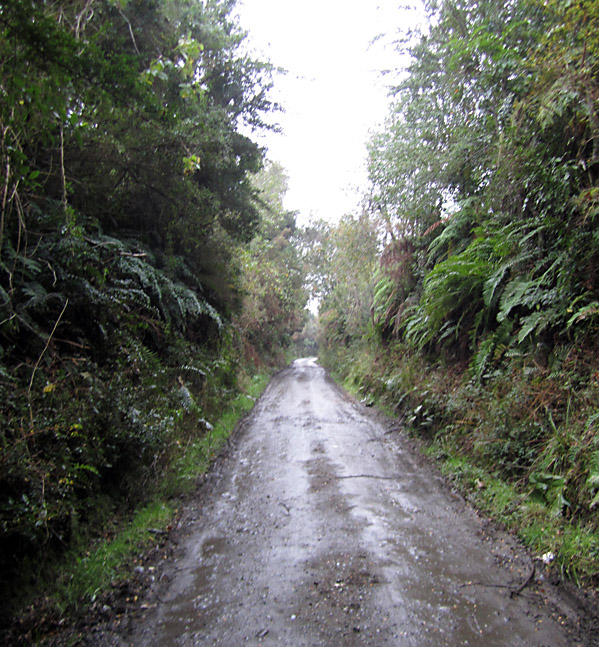
For the next kilometre or so the trackbed is an unmade road, but shortly before arriving at the pueblo of Pupelde the route is blocked, though might conceivably be accessible on foot. The photo below was taken in 2011 looking back northward along along the trackbed, perhaps one kilometre north of Pupelde.
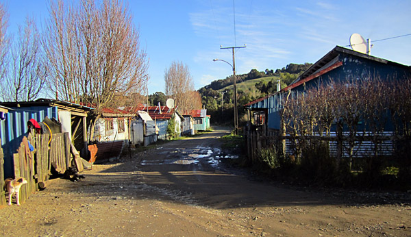
Within Pupelde the route again becomes accessible by car and is in fact the main access route for many of the houses. The next photo was taken at the site of Pupelde station, of which nothing remains.
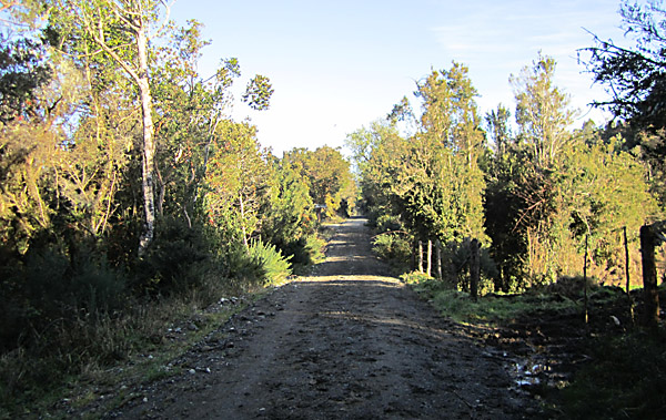
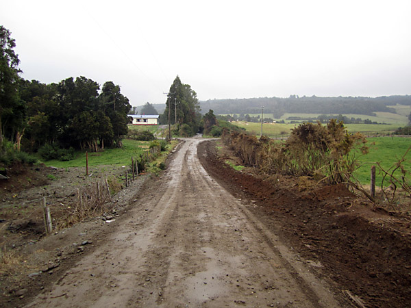
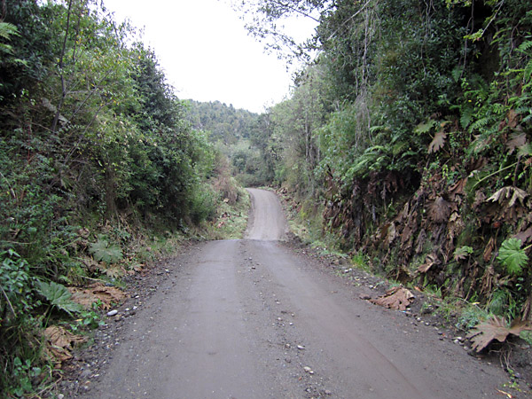
The trackbed continues to be an unmade road southward.
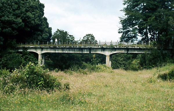
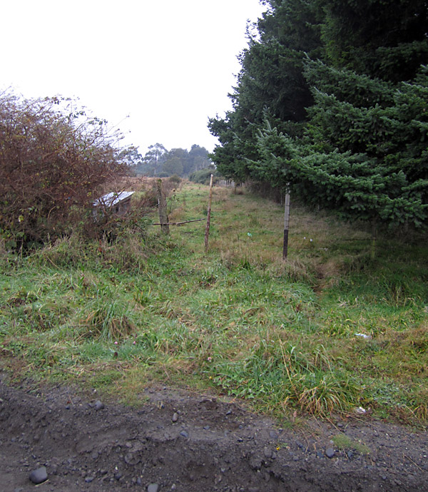
However, at a point some way before the line turned south across the valley of the Rio San Antonio it crossed a minor side valley on a bridge, as seen below. At this point the modern road turns inland, leaving the old alignment heavily overgrown just above the water level.
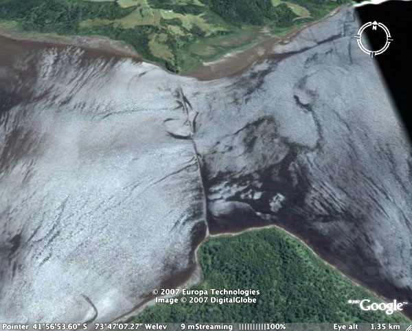
The earth movements resulting from the Valdivia earthquake in 1960 that contributed to the closure have had far-reaching effects. In particular, northern Chiloe effectively sank by several feet and thus parts of the route close to sea level have been flooded. This is particularly obvious at the site of the San Antonio bridge which was originally perhaps 50 yards/metres long but approached by straight embankments on both sides. The water is now about 1200 yards/meters wide and covers the embankments. Obviously modern maps do not show the old alignment crossing the flooded area. However, a view from the top of a nearby hill will still reveal the underwater embankments, especially at low tide, as will aerial or satellite views such as those available in programmes such as Google Earth. This Google Earth photo shows the site of the erstwhile San Antonio bridge. The route arrives from Ancud along the shore from the top right of the map to the top centre. It then ran south on a low embankment to a bridge perhaps 50m long over a sluggish tidal river and continued on a matching embankment to the wooded area at the bottom of the picture, where it turned south west. The whole 1200m of embankment and bridge is now under water and visible as a submerged causeway in the picture.
Coquiao A view along the trackbed as it approaches the crossing of the main Ancud to Castro road. The line crossed the road, curved sharply left, and ended up on the roadside verge several hundred yards further south.
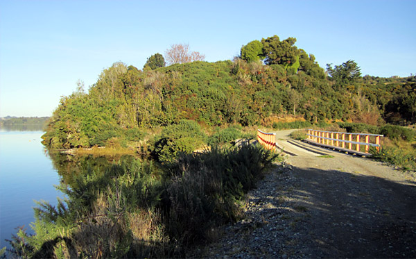
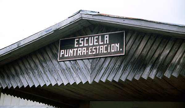
The rail route eventually curves right, just as the road begins an easterly curve the other way. From here the railway drops down towards Puntra bridge five or six kilometres further on, initially with a fairly straight course, but then more contortedly as it curves around the contours down into the valley. The construction contract specified a 260m. tunnel at one point along this stretch, but the length has not been examined closely, and no reference to such a feature has been found in any later documents. Puntra
Looking south from Puntra along the trackbed. South of the old station the line continues on a fairly straight course climbing gently. Much of this can be followed by car. Eventually there is a steeper decline down to the Putalcura river, and this might need four wheel drive.
Butalcura Photo taken looking west. Butalcura station is behind the trees on the left.
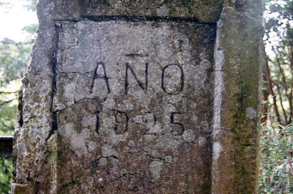
The date of construction is still visible cast into the concrete parapets.
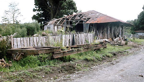
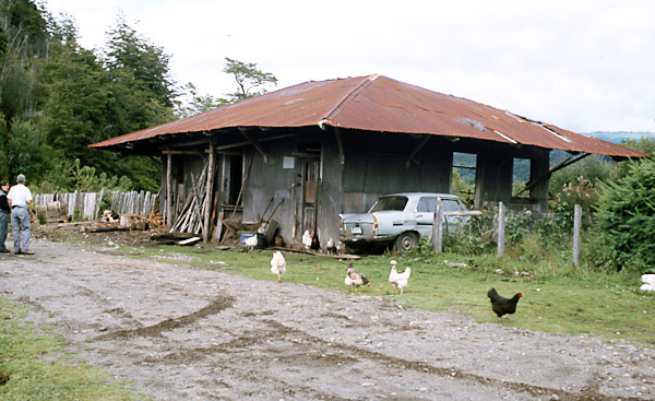
A few yards further on is Butalcura station, renamed from Putalcura because the railway found the implied use of the word 'puta' most improper. The station buildings are intact though somewhat battered. Chickens run around, and there is a derelict coach chassis still on its bogies. On the wall of the station one can still see the sign (illustrated on another page) warning the public not to use the track for driving animals! The station building is the structure with the (incomplete) corrugated-iron roof and wide overhanging eaves. The station-master's house is behind that. In the foreground is a carriage underframe still on its bogies. The raised ends and lower central well are clearly visible.
A view of the station building from the opposite direction.
From Butalcura station onwards to Mocopulli the trackbed has become an official minor road, and it appears on road maps as such. Initially it climbs steeply up the side of a valley to reach the plateau level. It is here that it becomes apparent that that the earthquake damaged the cutting sides more than the bridges. Much of the line was cut into soft mudstones. These are easy to excavate and normally hold a steep angle, but in an earth tremor they would collapse. It is clear from the irregular gradient that this indeed did happen. The resulting rock falls have been driven over many times and are no obstacle to road traffic, but the old smooth gradient is now more irregular. Once on the top of the meseta the alignment becomes almost straight for several miles. Further on a group of houses and a school lie at the old Km. 60 halt, and indeed are still known by that name. Mocopulli When the road begins to bend left the line leaves it, heading straight for the site of Piruquina station, and then bending left to commence a long straight south-westward all the way to Pid-Pid station. The first part of this is over-grown but after crossing the Pastahue and San Pedro road the trackbed then becomes a good quality earth road. Looking back northward along the overgrown trackbed, from the Pastahue road towards the site of Piruquina station.
Looking the other way, southward along the plateau-top straight towards Pid-Pid station.
At Pid-Pid the modern earth road deviates slightly from the railway bed for 100m, climbing over a hump rather than remaining on the railway's level. This suggests that the trackbed initially fell into disuse after the closure, only coming back into use after some sections had been forgotten about. Whilst the railway followed the obvious track beyond the crossroad in the distance, nearer to the photographer it ran just to the left of the camera, thus avoiding the hillock the the modern dirt road climbs over. The are no signs of Pid-Pid station, which was at the cross roads.
From now on the route starts to drop steadily off the plateau, and consequently becomes much more sinuous as it hugs hillsides and occasionally breaks out of a cutting onto a substantial embankment. The general direction is south-eastward towards the main road again. A view back northward along the railway shows it climbing up to Pid-Pid station through deep cuttings.
At one point a bridge has long since collapsed and the modern road follows a roller-coaster course down into a minor valley and then back up out of it.
A typical cutting side, showing the unconsolidated muds which permit perfectly good excavations with steep angles of repose until something comes along to disturb them - like a severe earthquake!
The excavated material from these cuttings was used to create large embankments across the intervening river courses. Here is one such, though now of course heavily over-grown.
Eventually the rail route breaks away to the right from the road which had adopted its course. It finally cuts through a deep and steep-sided cutting to reach the main road near Llau Llau, just south of the foot-bridge over what is now a short section of dual carriageway. This part is accessible on foot but only with substantial boots as there is mud in the cutting. Llau-Llau The photo shows the trackbed south of Llau Llau (looking south). There is a small embankment in the background.
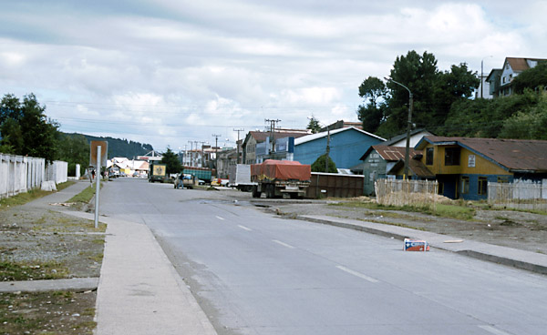
By now the line is generally falling towards Castro but there are still short climbs, a sign of the economies made in the construction. The route is still followable by car until one reaches the radio mast at Ten Ten (east of the sawmill on the main road). From then on a footpath follows the track down the east side of a valley, across an embankment to the west side and then falling steeply to cross the main road just on the outskirts of Castro. Castro The photo below shows the old station site today. The buildings on the right have changed little, and the space in front of them where the tracks ran is still open. The muelle is on the left behind the bushes. The town centre is uphill to the right.
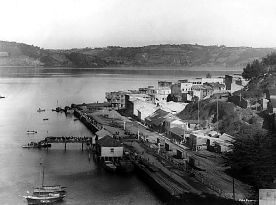
An aerial view of the same location whilst the railway was running shows a number of covered and open wagons along the line of the street shown above.
More photos References: 29-10-11 |
|||||||||||||||||||
Chapter 6
The Chiloe Island 60cm gauge railway