 |
|||||||||||||||
 |
|||||||||||||||
 |
|||||||||||||||
|
|||||||||||||||
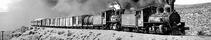
What's left? Since my first visit in 1975 most of the station sites have been cleared. However a number of buildings remain and the majority of the trackbed can be walked without difficulty. Obviously, examples of the 1922 locos and stock remain in use at Esquel, and also on the RFIRT line down at Rio Gallegos.
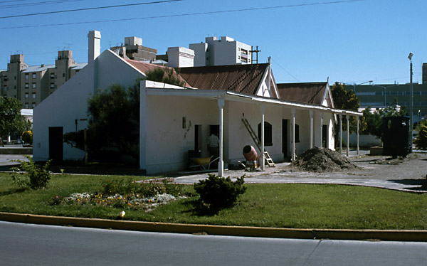
Puerto Madryn
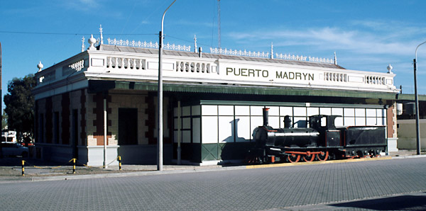
Puerto Madryn station building was the town's bus and coach station for many years. However, a new coach station has been recently opened (2000) behind on old railway land (behind the camera). The original building has not been opened as a town museum as once was proposed, but it does contain the office of the Centro de Studios Historicos y Sociales de Puerto Madryn (CEHYS). Metre gauge 2-6-0 no. 3 of 1888 has been moved to the erstwhile platform side of the building.
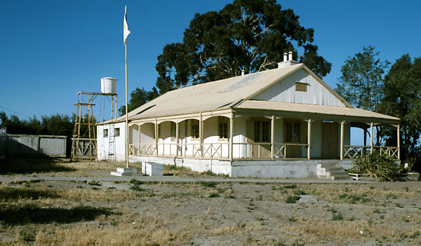
Up on the higher ground north of the station (from where many early photos were taken) is an old railway-owned house that may originally have been the manager's or engineer's residence. Later it became a technical school of some kind. It is now a listed building. Within its grounds remain the bodies of several 75cm gauge vans.
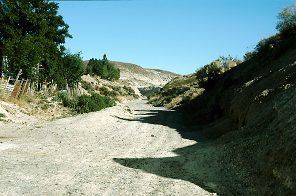
The trackbed can be identified along most of its length, but can easily be mistaken for other paths. In the absence of large-scale maps an explorer would be well advised to take print-outs from Google Earth or the like to help identify the route. This view was taken on the hillside above Puerto Madryn, and it can be seen that a storm-water gully has cut through the railway's low embankment in the foreground. Whilst walking the trackbed is possible, the long distances make a mountain bike more suitable.
Trelew The platform side of Trelew station, now surrounded by gardens, and with the contractor's O&K loco just visible on the right.
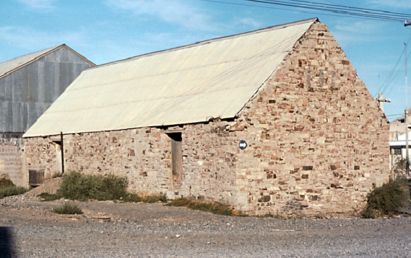
In 1975 the Trelew goods sheds were still in use, including a stone-built one which would have looked quite at home in Wales. However these have now been demolished.
Rawson Gaiman
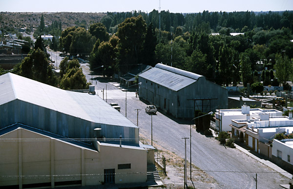
In the aerial view below, taken from above the tunnel mouth looking east, the goods shed is clearly visible with the station building in shadow beyond. The 1909 extension to Gaiman terminated along the line of the street, but the 1915 line on to Dolavon had to branch off further back, curving through the site of the new sports centre in the left foreground.
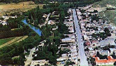
An aerial shot of Gaiman taken in the 1970s is also shown. The photo was taken looking west . The original plan was for the railway to run along just to the right of the river. However, the actual course adopted is just off to the right of the picture. (2)
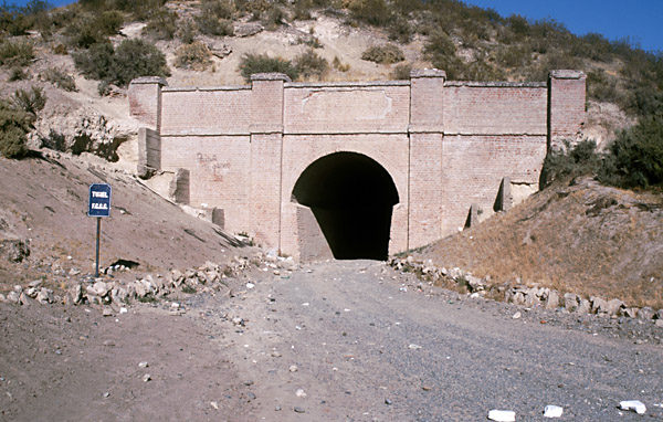
The eastern end of Gaiman tunnel. The brickwork remains in excellent condition and the tunnel can be walked or even driven through, as long as you are prepared for a dark spot in the middle where the curve hides both ends.
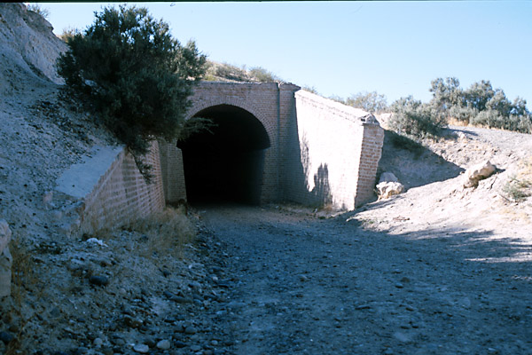
The opposite end, facing north into a long cutting.
The view from the tunnel mouth.
And a high level photo showing the trackbed heading north before it turns west again.
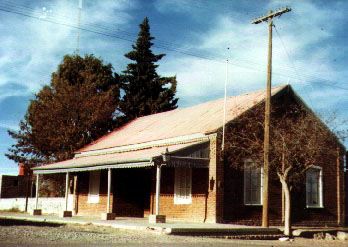
Dolavon station, as seen in 2004.
The 1920s alignment
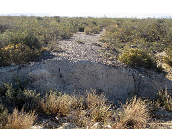
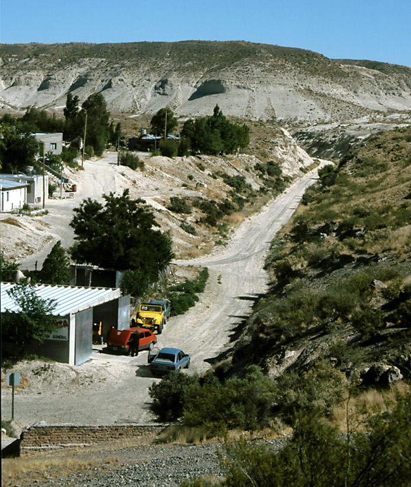
The far end of the trackbed, beyond Campamento Villegas, is clearly visible from the main road. It is usually within a couple of hundred yards (metres) of the road. In the photo below a shallow embankment can be seen amongst the scrub.
References:
18-10-10
|
|||||||||||||||
Main pages
Appendices
Chapter 2
The Welsh-built Central Rly. of Chubut