|
||||||||||||||||||||||||||||||||||||
 |
||||||||||||||||||||||||||||||||||||
 |
||||||||||||||||||||||||||||||||||||
|
||||||||||||||||||||||||||||||||||||
Taking salt to the sea 1, the FC de la Península Valdéz
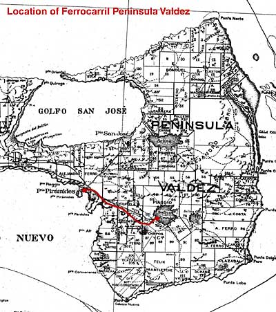
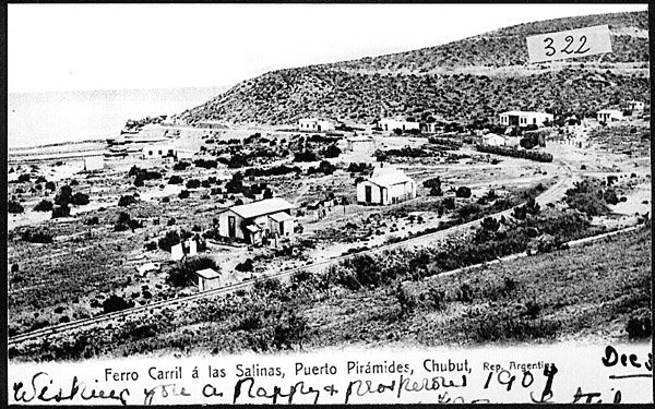
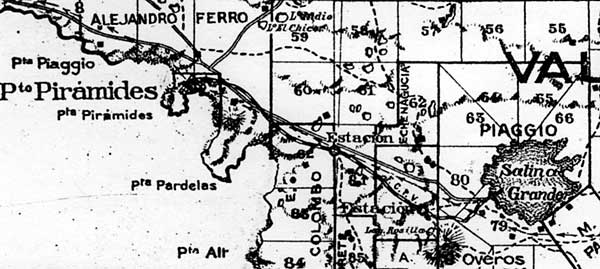
On the Valdés Peninsula north-east of Puerto Madryn there are large salt pans lying well below sea level (see photo above). In 1900 Ernesto Piaggio obtained a government concession to build a 76cm. gauge railway from Puerto Piramides to the Salina Grande salt pan, twenty miles (34km.) inland (1). The line opened in June 1901, and was transferred to a salt extracting company, Ferro & Piaggio, owned by Piaggio, the brothers Alejandro and José Ferro and a Señor Munno (or Musso?) two years later. The Ferro brothers owned the largest estancia in the area and even today it is still in the Ferro family. Eventually the business, La Salinera Argentina, reverted to Piaggio y Cia. Ernesto Piaggio also ran ships down the Patagonian coast. Somewhat puzzlingly, E. Piaggio applied for and was granted a concession to build a railway from the salt pans to an alternative port, San José on the north side of the isthmus, in 1904 (2). There is no evidence that this was ever begun, and it may well have been one of those proposals intended more to apply pressure on a third party than to be actually constructed. The company had the rights to 15,000ha of the Salina Chica, but it was their 25ha in the Salina Grande which was worked for domestic salt. In the best years they extracted up to 12,000 tons. The map extract below shows the peninsula, with the railway highlighted in red. This, and a larger scale extract further down the page, are taken from a Chubut land ownership map of the 1920s (3).
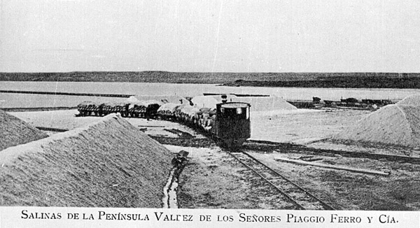
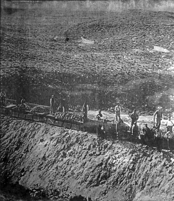
A locomotive and train in the salina. Mounds of salt can be seen.
The route
A 1930 photo, after the closure of the railway but before it was dismantled, looks the other way from the jetty inland (13). There is track visible at low level to the right of the picture, but none on the upper ledge to the left.
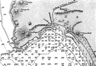
In the photo below the line has reached the bottom of the port's bowl and crosses from bottom left to middle right before terminating top left at the muelle (10) To confuse matters, the Admiralty chart section below (from chart no. 3226, edition of 1931) shows the line climbing northwards from the bay before turning east. This chart acknowledged an Argentine Government plan of 1917 as its source for topographic detail.
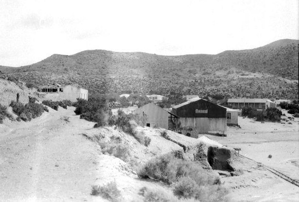
Another 1930 photo looks down into the bowl which contains Pto. Piramides from the east (13). The present day track from the town to the east can be seen as a steady gradient climbing the hill on the right of the photo. This may have been the railway route but it is very steep for an adhesion-worked line.
An enlarged extract of the land-ownership map shown earlier is reproduced below. The railway can be seen as a black and white hatched line leaving Pto. Piramides eastwards before turning ESE and running mostly on the south side of the original road to the salina. Two intermediate stations are marked before the line makes a final turn to drop north-eastwards into the depression holding the salt pan. The names Piaggio and Ferro, the railway's main backers, show up clearly as owners of a number of plots of land.
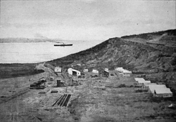
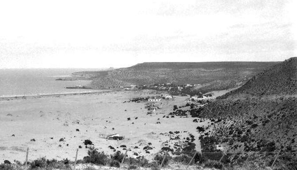
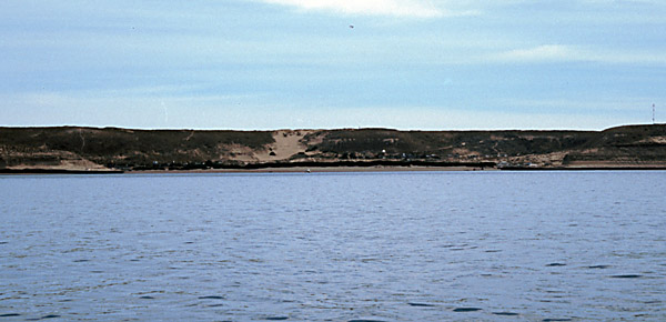
Puerto Piramides bay and basin from the south. The flat-topped nature of the peninsula can be seen. The muelle was at the left (west) end of the bay, and the railway ran from there back across the low ground behind the pueblo before starting its climb eastward.
Engines, wagons and a coach
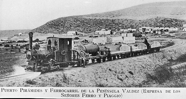
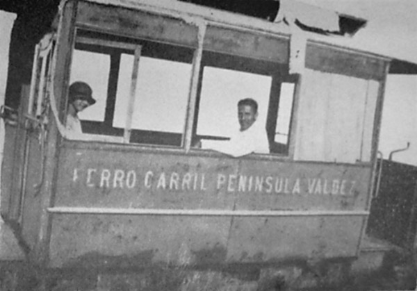
The line possessed three or four stations and was obviously run as a proper passenger-carrying railway, for as well as ten bogie wagons there was a passenger coach. A list dating from 1903 suggests that there were as many as thirty wagons in total, and one furgon (7). 1902 traffic figures quoted in the same report were 2330 tonnes of goods but no passengers. Conflicting reports tell of rails weighing 3, 5 & 7 Kgs. per metre or 10, 15 and 27 Kgs which sound more likely. The latter figures come from the 1902 Estadística volume which also suggests that 15 kms. had steel sleepers whilst 17.8 kms. had wooden ones. Buildings were reported as being fairly precarious - galpones, houses and police post all being faced with corrugated iron, though that is not unusual in such a dry climate. In 1900 one driver was the father of George Thomas who became the station-master at Trelew (8). Passenger fares are recorded as having been $1m/n single and $1.50 m/n return. The photo below shows what is probably the Krauss 0-4-0T at the same point as the picture above, just about to start the climb out of Puerto Piramides. The wagons are bogie stock with semi-circular ends. One of them has been converted into a water carrier.
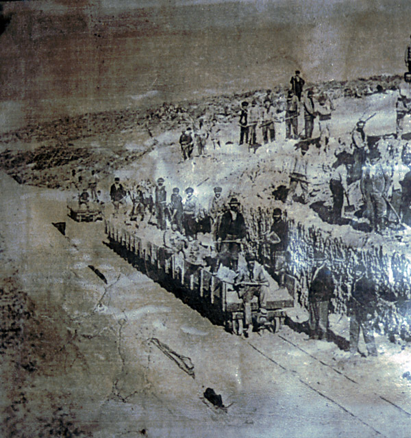
The pictures below show wagons in the salina. Those in the first picture appear very different from those seen above. They seem to have substantial wooden sides. The wagons in the second picture may be the same as those in the previous one but this time the sides have been let down.
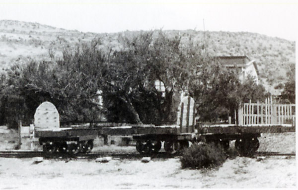
A pair of bogie flats, one with semi-circular ends, stand at Pto. Piramides.
The picture below shows the single four-wheeled coach as it was after some years of abandonment in the early 1920s (10). It appears to have had end balconies with a hand brake handle attached to at least one of the end handrails, and a clerestory roof. This is very similar to small carriages supplied by Messrs Koppel to other railways in the first decade of the 20th century.
Closure Remains
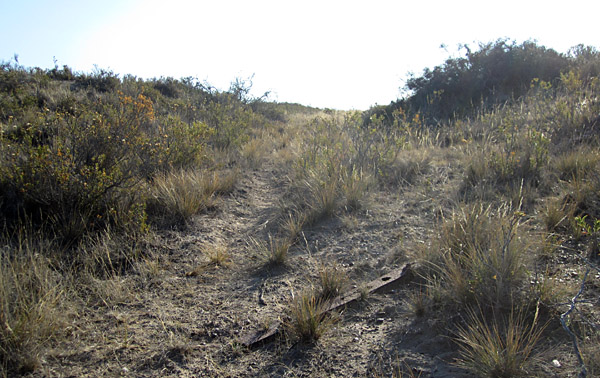
The trackbed is also visible in specific places, though only where earth works or other features draw attention to it. In a dry climate the track was largely laid directly at ground level. Ninety years since closure mean that the local thorn scrub has had plenty of time to obscure the route, and for much of its length only an observer in an aircraft (or using Google Earth) would be able to identify the location of the rails.
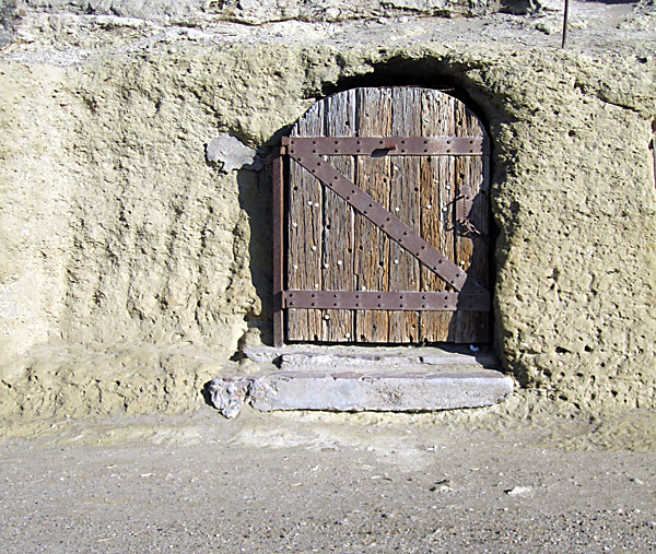
Starting from the ship loading point at the west end of Puerto Piramide, the obvious path for the railway is visible as a ledge which passes behind some of the tourist kiosks and cafés. However, see the 1930 photo above which shows track only at a lower level. There also survives a door hiding a cave in which salt and other cargo was kept.
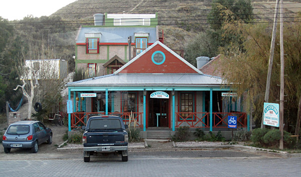
The railway's route comes out onto the main street and heads eastward along it. There is a café named La Estación but whether this was truly the railway's own station is not clear.
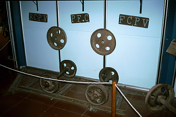
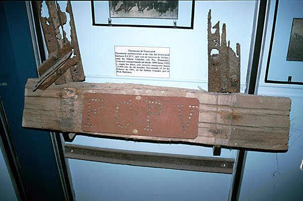
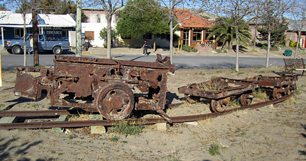
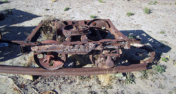
Some years ago the battered frames of one of the locos, and a pair of wagon bogies, were retrieved from their watery grave in the sea. They are now displayed by the side of the main street, Avenida de las Ballenas, where it widens out to form a plaza. However, be warned, these are the most rusty relics ever seen. If they had been constructed of steel rather than iron they would probably not have survived at all. As it is one wagon axle is a modern replacement and most of the wagon wheelsets are not attached to the frames.
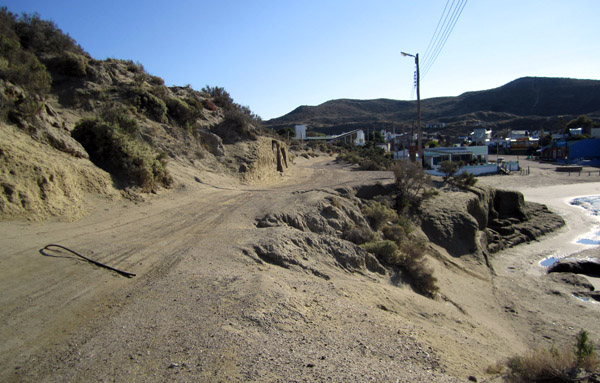
The railway must then have diverged left from the main street and take the route up the hillside followed by a modern track. This is very steep for a railway, possibly 1 in 20 at best, but there seems no alternative. At least the uphill trains would have been largely empty. Señor Jorge Waddell of the Fundación Museo Ferroviario in Buenos Aires has speculated that the railway may have used a zigzag to gain height at this end of the line as well as at the salina, but no physical evidence to confirm this has yet been found (12).
Out on the meseta the route is only occasionally visible, as explained above. There are one or two places where it can be identified from the main peninsula road, particularly near the right-angled bend which the road makes east of the town before heading south-east towards Punta Delgada.
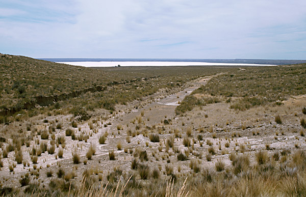
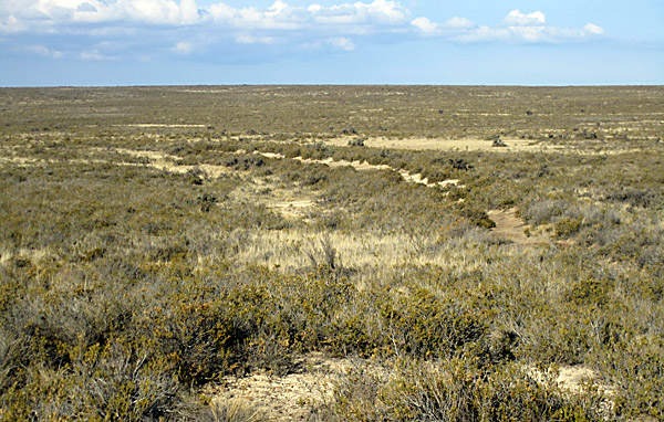
These two photos, above and below, were taken from the same point where an embankment is visible south of the road. Looking west (above) shows a shallow cutting, with one iron sleeper still in view. Looking east (below) a low embankment curves slightly as it heads towards the salina.
The route continues to parallel the main road until the final descent into the salina. However the majority cannot be seen from the road and would need investigation on foot.
The trackbed crosses the main road diagonally, roughly at the point where the farm track to 'Los Manantiales' leaves the road. From this point on the route has not been followed yet. If any reader does adventure this far, please remember that this is all private land and that permission should be obtained from 'Los Manantiales' before setting out. Further advice will be gladly given if you contact the authors. Do remember that this is semi-desert and a long way from help, so make your preparations carefully. No maps cover the area in sufficient detail so it would be sensible to carry printed extracts from Google Earth or other hi-res satellite photography source.
The visit in 2011 showed that much of the south side of the salina is currently covered in sand rather than salt. If tthat was always the case it may be that rail tracks ran further out across the flat surface, not merely starting near the edge.
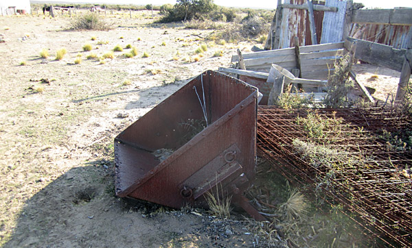
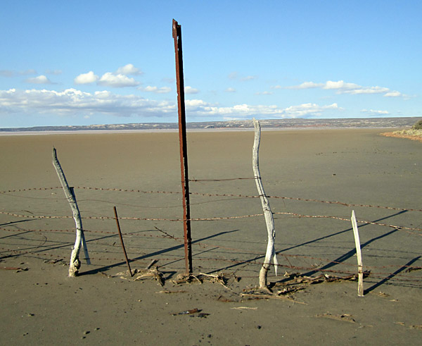
Whilst the actual route down to the salina has not yet been followed, a preliminary reconnaisance in May 2011 did reveal a number of relics, so there may yet be more to find. Above is a skip body lying in a farmyard, whilst below is one of a large number of lengths of rail, in this case serving as a fence-post on the salina itself. If anyone does explore further, we would very much appreciate any additional information, and any photographs.
References: 3-9-11 |
||||||||||||||||||||||||||||||||||||
Chapter 12
Salt carrying railways